
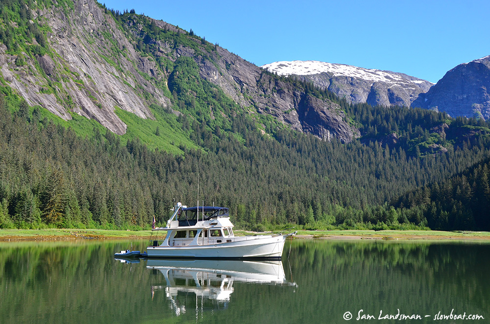
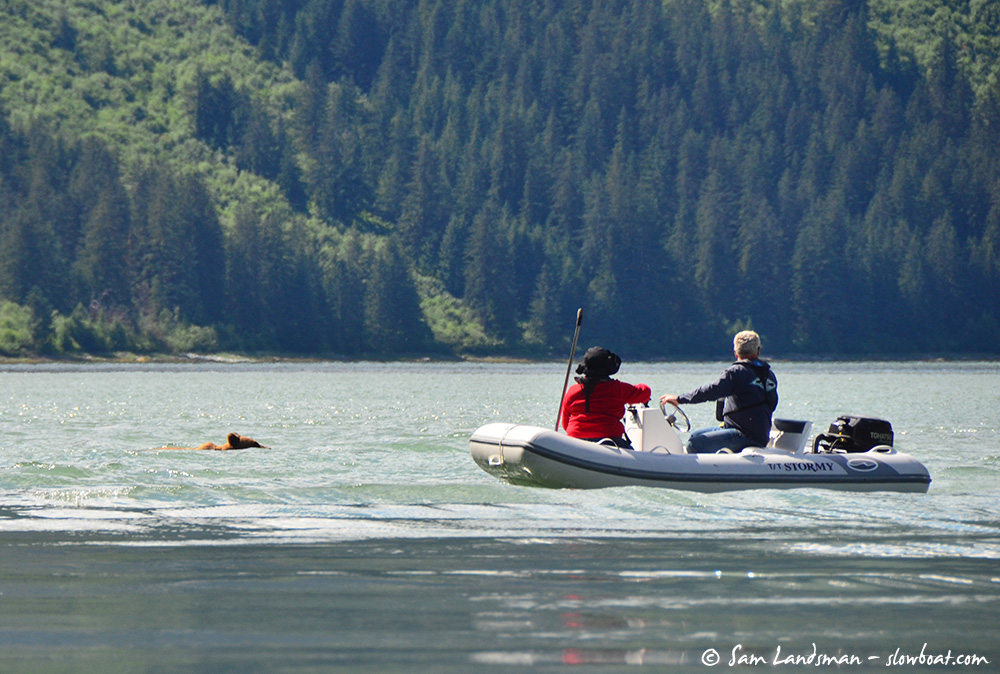
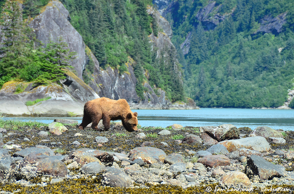
Ford’s Terror might just be the most beautiful place on the planet. Cliffs—absolutely humongous granite walls, really—rise from water’s edge to snowcapped bowls and peaks 5000 feet above. Countless waterfalls, some trickles, others torrents, plunge from these peaks. Bears forage ashore. Dolphins frolic around anchored boats.
The scale of Ford’s Terror is difficult to comprehend and impossible to convey. It’s like Yosemite, but with water in the valleys, no crowds, and more wildlife. Everywhere you look—everywhere—the view is magnificent.
Visiting Ford’s Terror isn’t for the faint of heart, though. It’s wilderness cruising, far off the beaten path and far from help. These are the primary challenges:
It’s uncharted. Okay, it’s kind of charted. But not accurately, and not completely. The safest entrance takes you directly over a charted rock, which doesn’t actually exist, in order to avoid three drying shoals, which are all uncharted.
It has a tidal rapid. And to get to the anchorage, you have to pass through it. Tougher yet, there’s no publication to tell you when slack water is, and the time varies from day to day.
It’s remote. No cell phone service, no VHF link to the coast guard, no sat phone service even, no calling for help. Self-sufficient boaters only, please. But Slowboat is here to help! We’ve spent a bunch of time in Ford’s Terror, exploring by dinghy and drone to help demystify this magnificent place.
Navigating the Entrance. The entrance to Ford’s Terror is the tricky part. Yes, it’s poorly charted, but it’s easily navigated near high-water slack. Least depth is about 24 feet, and we’ve seen boats as large as 130 feet safely enter.
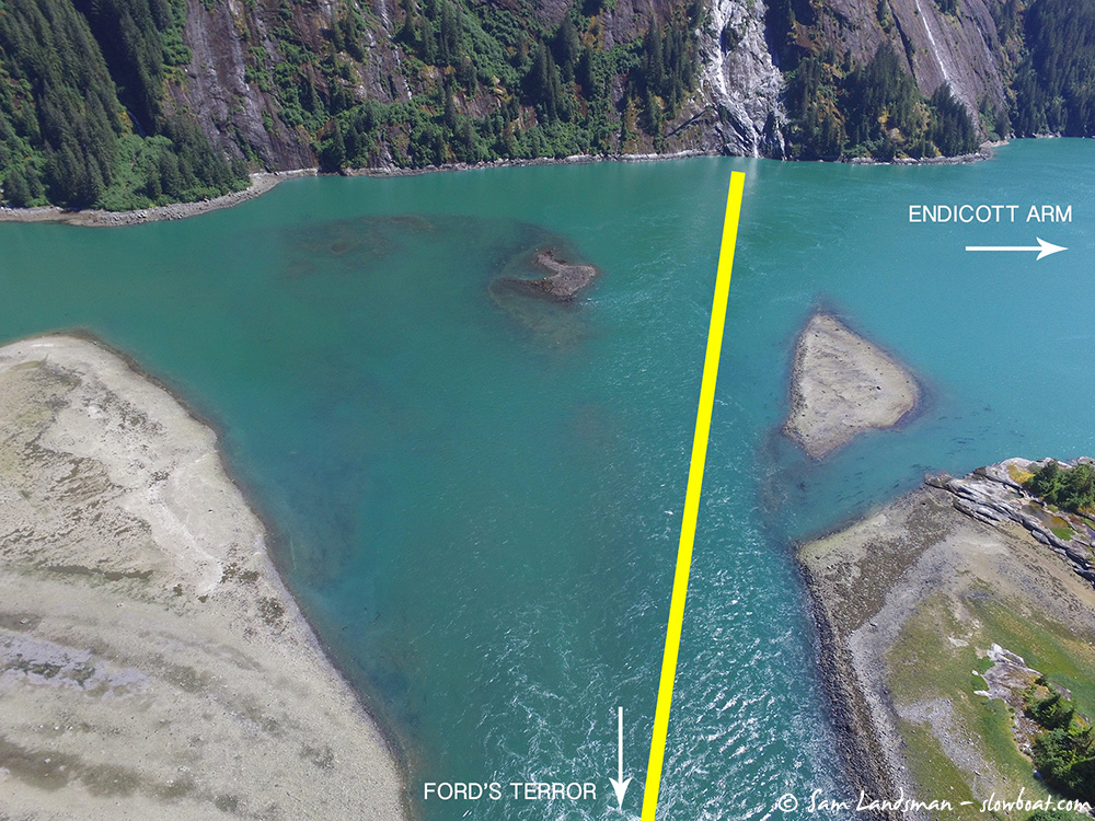
The key when entering is to disregard what you see on your chart. Yes, it takes courage to run right over a charted rock, but that’s the best way in. The screenshot below, taken from the Navionics iOS app, shows our route.
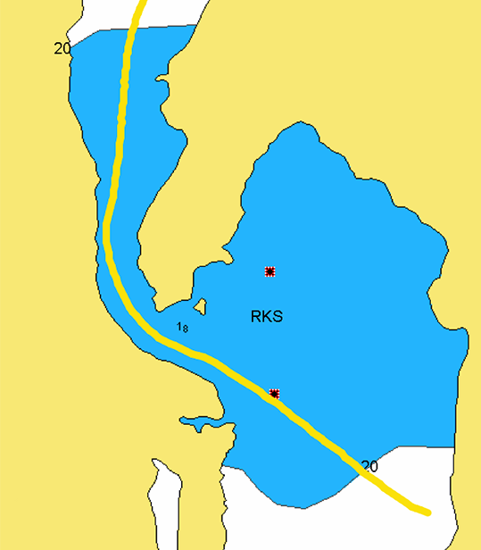
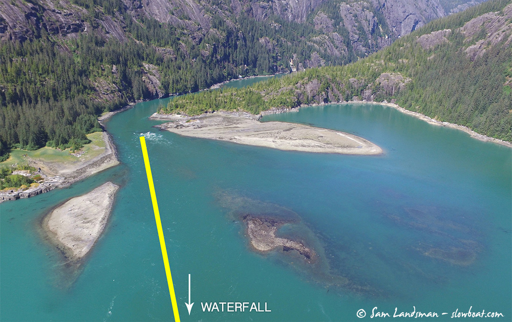
When entering, navigate to the waterfall seen at the top of the picture below. From the waterfall, steer a course towards mid-channel in the rapids. The yellow line in the picture illustrates the route we prefer.
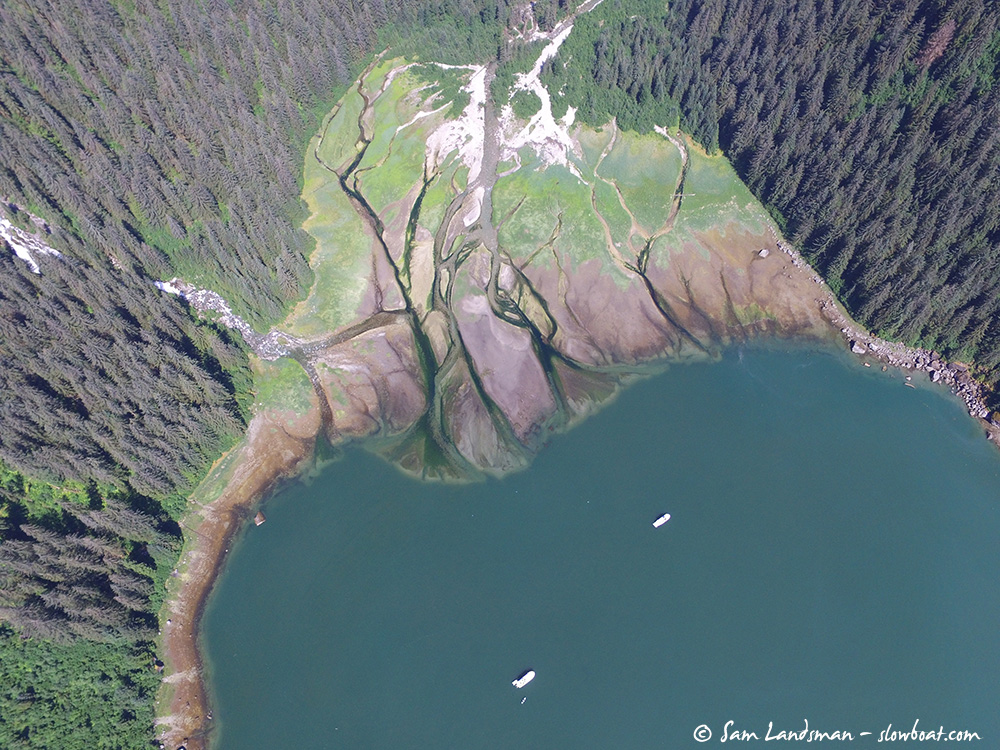
Here’s an aerial looking towards the rapids from the waterfall. This photo was taken near the bottom of a 1.2-foot tide.
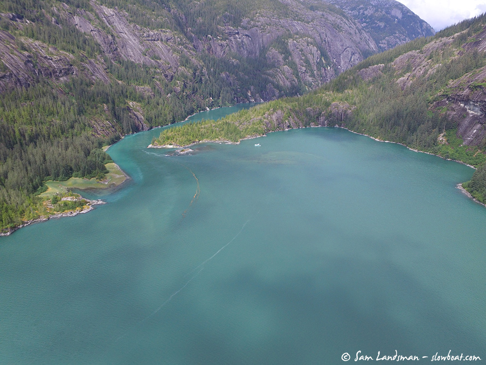
And the same area at high water, when you’ll be entering:
Timing. We recommend entering Ford’s Terror at high water slack only. High water gives sufficient depth for even the largest cruising boats that would likely visit Ford’s Terror, and slack is important because the current at the entrance can reach velocities of more than 12 knots.
High water slack at Ford’s Terror occurs between 15 minutes and 60 minutes after high water in Juneau. The precise timing depends on a variety of factors—primarily the size of the tidal exchange and the amount of fresh water entering Ford’s Terror from rivers and waterfalls.
Our best advice is to arrive at the entrance at high water in Juneau. Use your binoculars to peek into the rapids. If you see white water, wait. When the water looks like it has stopped, go.
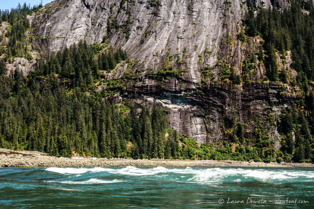
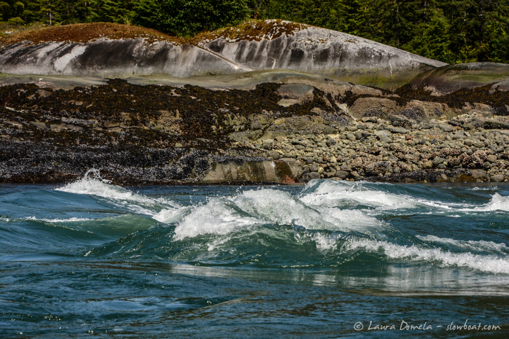
Particularly towards the bottom of the ebb, the rapids at the entrance are hazardous. A series of large overfalls are a major hazard. And regardless of ebb or flood, the current sets boats onto a rock wall. How bad can it be? Check out this video (fast forward to 2:25, and make sure the volume is up).
At high water slack, though, the entrance is easy.
Anchorage. The best anchorage is at the head of the west arm. The challenge here is how quickly the water shoals as you approach shore. We’ve found the best strategy is to drop 200-250 feet of rode in about 110-120 feet of water and back towards shore. Despite only using 2:1 scope, we’ve never had a problem with the anchor setting, and we wouldn’t want to be any closer to shore.
Entering the east arm is hazardous. A spit extends from the north shore almost entirely across the channel, and a few uncharted rocks lie off the south shore. Even at high water, there’s only about 10 feet of depth, and the bottom is highly irregular. Rapids form when the tide changes. Enter by dinghy only.