Windy.com is our single favorite weather resource for cruising the Pacific Northwest. We never ignore the official NOAA or Environment Canada marine forecasts, but Windy offers a much more granular look at the weather. Environment Canada and NOAA forecasts cover large areas over many hours with wind speeds expressed in big ranges (10 knots or more). Windy allows you to pan and zoom to the area you’ll be traveling, and to step through the forecast (several forecasts, actually) in one-hour increments. Plus, it’s beautiful to look at and play with!
Here’s a real-life example of how Windy can help make cruising safer and more comfortable. The northwest coast of Vancouver Island is a huge forecast zone, stretching from north of Cape Scott to south of Brooks Peninsula. Environment Canada’s forecast for the area has to include the worst conditions anywhere in that forecast zone, but those conditions might have no bearing on your route. On both our trips around Vancouver Island last summer, for instance, Environment Canada called for 20-30 knot winds the day we rounded Cape Scott. We had calm conditions. Many would attribute this to poor or conservative forecasting, but that wasn’t the case. It really was that windy further south, off Brooks Peninsula. Windy helped us more fully understand the Environment Canada forecast, showed us that the wind would indeed blow in some places, but not along our route (we confirmed this day-of with weather reports from buoys and lightstations).
The default Windy.com settings aren’t ideal, though. Below we’ll share a few tweaks that we use to get the most out of Windy.com.
Overlay live conditions. To get a sense of how accurate the models have been, we like to keep an eye on observed conditions and compare them to predicted conditions. Turning on “Reported wind” overlays live conditions from weather stations all over the world. Many of the weather buoys and other important weather observation sites along our coast are included, making it easy to get a big picture idea of what’s happening.

Download the app. It’s free for iOS and Android. The app is full-featured and easy to use and much better than the website when on mobile devices.
What model? Windy displays three different weather models for our area: NAM 5km (doesn’t include all of BC), ECMWF 9km, and GFS 22km. We’ve found the ECMWF 9km most accurate. If there is a big disparity in what the models are forecasting, we err on the side of caution and make decisions based on the model that predicts the worst conditions. Below are screenshots (taken at the same time) of the NAM and ECMWF models for the Puget Sound area.
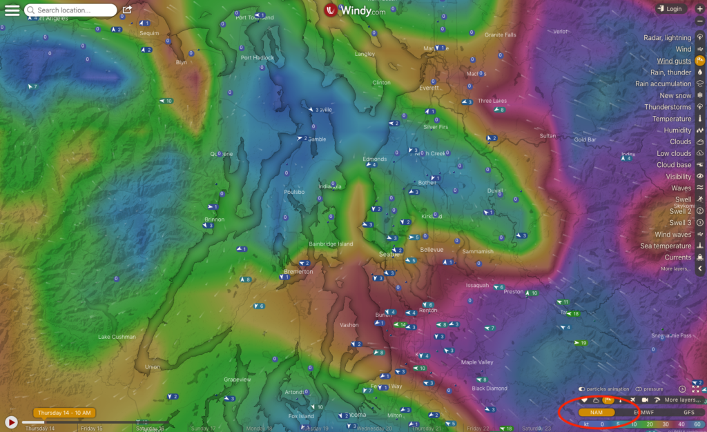
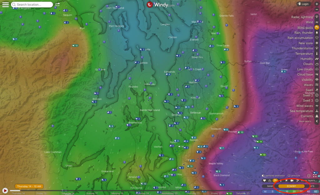
Check the forecast time. The models typically refresh twice a day. Know how new (or old) the forecast you’re looking at is. To do this, click “About these data” (the small clock icon) in the lower right corner of the page.
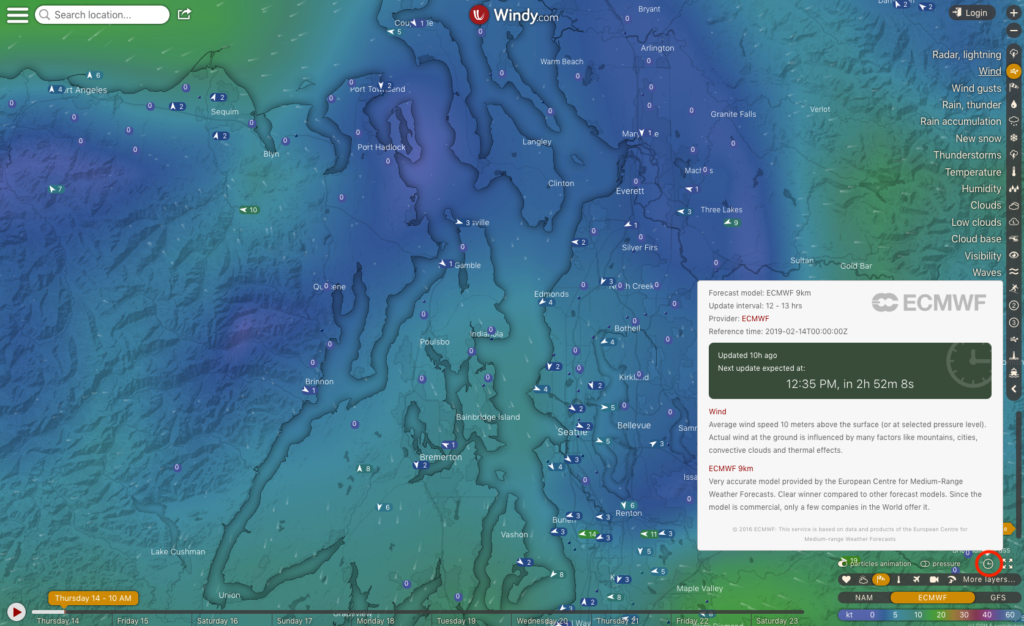
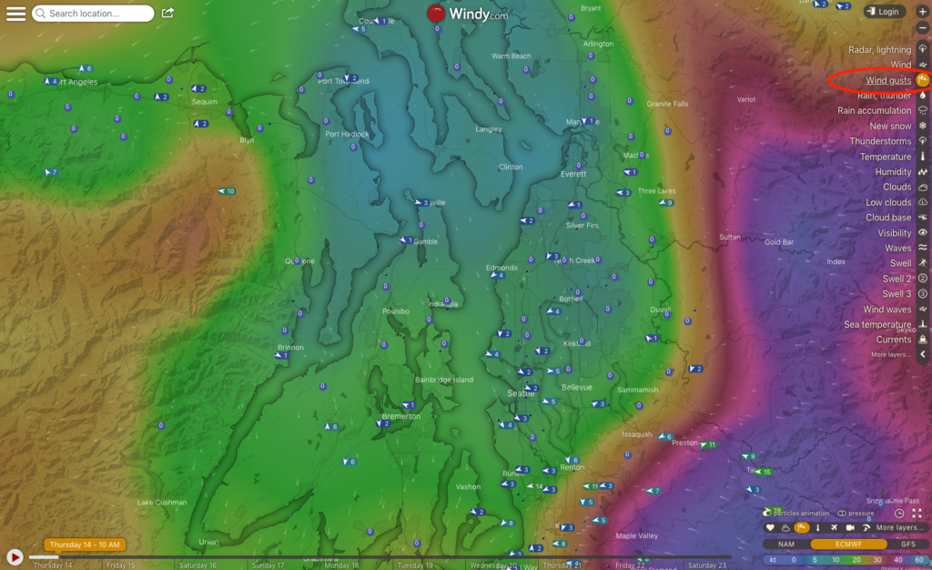
Look at gusts. We’ve found the gust forecast more indicative of actual conditions than the regular wind forecast.
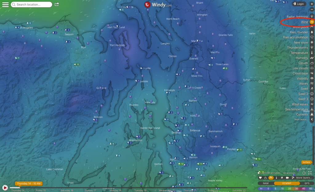
Click on a point. You can click anywhere on the map and get an instant forecast for that location. This can be helpful to see how the wind speed changes over time.
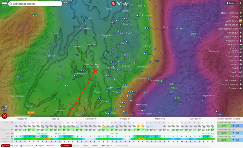
Watch for trends. Sometimes the forecast is off by a few hours, other times it underestimates or overestimates wind speed, but it’s rarely entirely wrong. If the trend is for increasing wind, particularly if the increase is significant, use caution! The weather could come earlier and be worse than predicted.
Beware of Johnstone Strait (and other local effects). None of the wind websites we’ve used is better than Environment Canada for Johnstone Strait. We think this is because local geographic factors play an unusually large role in Johnstone Strait weather. Our best advice on Johnstone is to keep an eye on the weather at Fanny Island weather station and be ready to go when it calms down!
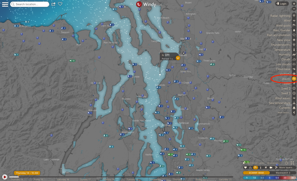
Look at wave forecast. This isn’t all that useful on inside waters, but on the ocean the wave forecast provides insight into the size of the swell. We don’t rely on this information, but it can be helpful in deciding if today or tomorrow (or another day) is likely to be smoother on the ocean.
Don’t disregard any forecasts. If Windy shows a substantially different forecast than NOAA or Environment Canada, we don’t ignore either forecast! Instead, we seek additional information, like real-time conditions from buoys and lightstations, to see how forecast conditions materialize.

