Day 15 | Alaska Flotilla Leg 4 | Skull Cove to Alert Bay

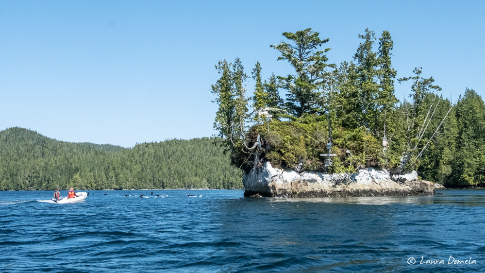
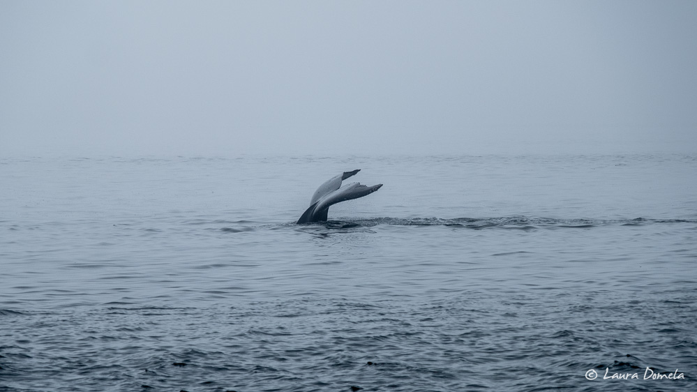
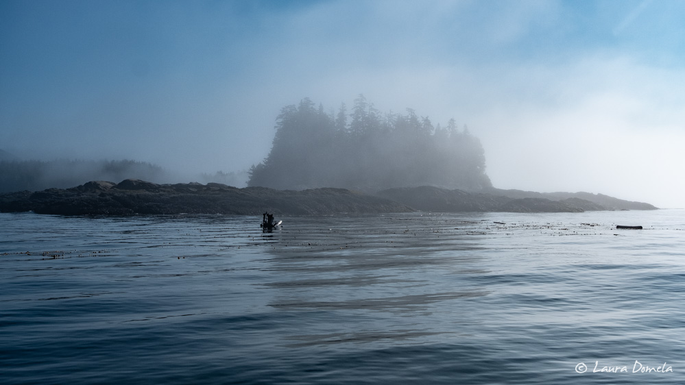
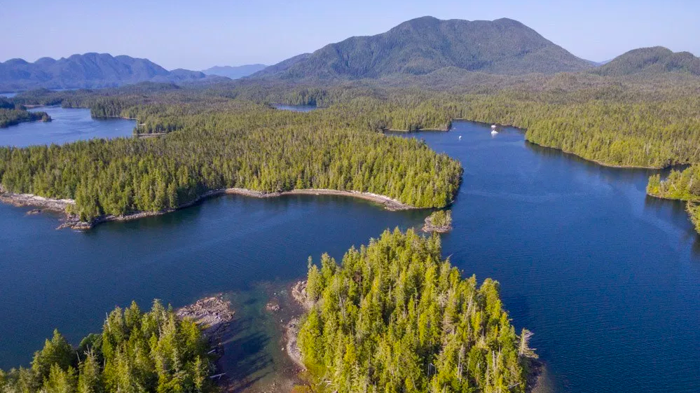
We departed Skull Cove (in fog, again) and headed for Alert Bay via Ripple Passage. We soon spotted a small pod of orcas in the distance, and slowed to take a few photos. While we were focused on the distant pod, a few more surfaced much closer to our boat (almost too close to capture them with the long lens we were using!) Queen Charlotte Strait was shrouded in fog … Read more

Day 14 | Alaska Flotilla Leg 4 | Pruth Bay to Skull Cove

We’ve been watching the weather at Cape Caution for the last several days, and today looked ideal. Environment Canada predicted variable 5 to 15 knot winds. Windy showed gusts in the single digits until mid-afternoon and seas of just two feet. Tomorrow looked just as good. We’d originally planned to spend another night north of Cape Caution. But when the weather looks perfect, why wait for it to possibly get worse?  … Read more

Day 13 | Alaska Flotilla Leg 4 | Shearwater to Pruth Bay

Forecast: Wind light becoming northwest 10 to 20 knots in the afternoon (Environment Canada Central Coast). Mostly sunny, high around 75. We didn’t have all that far to travel today (about 40nm), but we still wanted to get an early start. We were done with chores at Shearwater, and Pruth Bay—which we’d skipped on the way north—is a more fun place to spend time. We left Shearwater in thick fog, … Read more

Day 12 | Alaska Flotilla Leg 4 | Lambard Inlet to Shearwater

We left around 9:00 a.m. this morning. Shearwater is only 19nm from our anchorage here in Lambard Inlet, and there was no point arriving early just to find the docks at the marina still full from last night’s occupants, so we lounged around leisurely this morning before we pulled anchor. Shearwater is a busy place this time of the summer, so we made a point to call over a month … Read more

Day 11 | Alaska Flotilla Leg 4 | Meyers Narrows Cove to Lambard Inlet

Our departure from Meyers Narrows Cove was dictated partially by the tide. The narrows have depths in the single digits, and with the tide falling we didn’t want to take any chances. We left about 6:30 a.m., with a 5 foot tide, and had at least 12 feet under the keel the whole way through. We’ve been hearing rumors that Shearwater (the next scheduled stop where we can fill our … Read more

Day 10 | Alaska Flotilla Leg 4 | Penn Harbour to Meyers Narrows Cove

We were a little concerned about the weather this morning. Environment Canada predicted 25-30 knot northwesterlies out on Hecate Strait, and we feared this wind might make things a little bumpy, particularly as we exited Surf Inlet and turned south into Laredo Channel. This corner is somewhat exposed to wind and seas that originate in Hecate Strait but wrap through Caamaño Sound. Worse, we’d be leaving on the ebb, which … Read more

Day 9 | Alaska Flotilla Leg 4 | Patterson Inlet to Penn Harbour

The forecast called for improving weather today, at least in terms of precipitation. No rain was in the forecast, and it looked liked it might even get sunny, but the fog would need to burn off first. We had more than 50nm to travel, so we got an early start and spent much of the day navigating by instruments. Navigating by instruments is actually pretty easy, especially in the lightly … Read more

Day 8 | Alaska Flotilla Leg 4 | Captain Cove to Patterson Inlet

Today was an easy day: no weather concerns, simple navigation, and not far to go. Along the way we spotted a few dolphins. A long, narrow, easily navigated channel leads to Patterson Inlet, which indents Pitt Island. Along the way we saw this sign. We’re not sure who made it, but we’ve seen others like it at nearby anchorages. A little further in we saw this eagle, preening its feathers: … Read more